Special Edition: Retracing the Battle of the Bulge Part 2
Monday evening – June 13, 2016 (eighteenth post of this travelogue)
Before we start this post, I wanted to post a quote from Wiki:
World War II (WWII or WW2), also known as the Second World War, was a global war that lasted from 1939 to 1945, although related conflicts began earlier. It involved the vast majority of the world's nations—including all of the great powers—eventually forming two opposing military alliances: the Allies and the Axis. It was the most widespread war in history, and directly involved more than 100 million people from over 30 countries. In a state of "total war", the major participants threw their entire economic, industrial, and scientific capabilities behind the war effort, erasing the distinction between civilian and military resources. Marked by mass deaths of civilians, including the Holocaust (in which approximately 11 million people were killed) and the strategic bombing of industrial and population centres (in which approximately one million were killed, and which included the atomic bombings of Hiroshima and Nagasaki), it resulted in an estimated 50 million to 85 million fatalities. These made World War II the deadliest conflict in human history.
Those numbers are beyond comprehension. While I generally trust Wiki, I did a verification search and found this site (link). That site breaks down the deaths in some great detail. Their total is 48 million and that does not appear to include the Holocaust victims. The Holocaust numbers would add well in excess of 10 million more deaths (link). The first site lists 400,000 US troops killed. Another source lists various 83rd division facts and says that nearly 3000 soldiers of that division were killed.
Friday (6/10) we drove the east loop to trace the last part of the Battle of the Bulge route. For clarification, I am again including the maps involved.
Note: you can click on any of the pictures in any of our posts to get a large view.
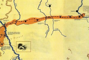
The approximate route we will trace
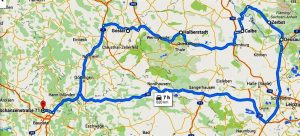
Battle of the Bulge east loop
We started the tour in Goslar (note Einbeck to the west where we left off yesterday). Our tour continued to Zerbst which was the location of the end of the Battle of the Bulge.
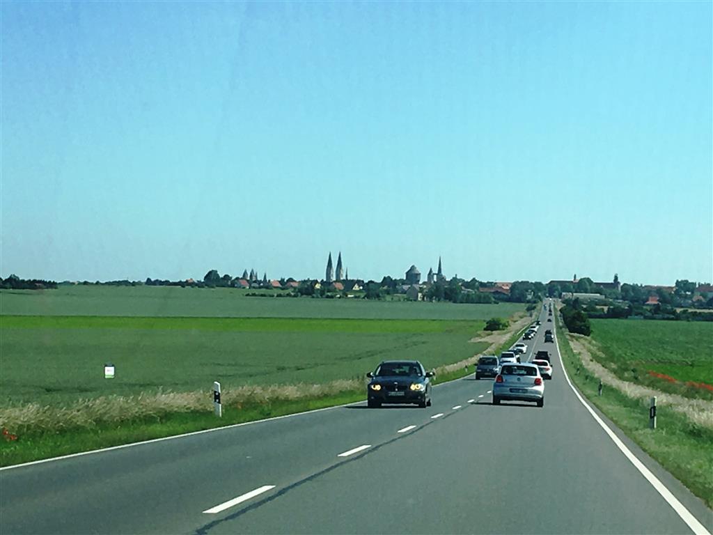
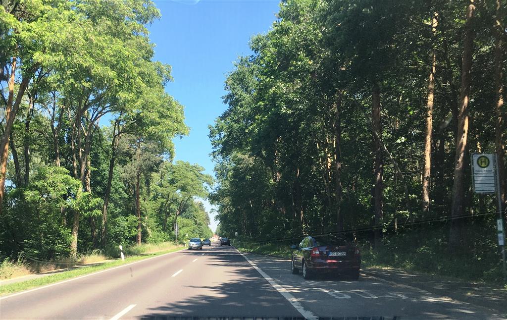
In both tours we noted that this part of the Bulge route did not involve mountains. Rather it was mostly farm land and dense forests (pictures).
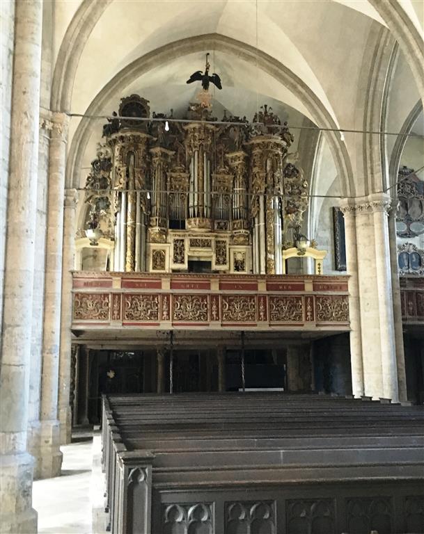
We drove into several towns along the route. Most were not all that remarkable until we reached Halberstadt (link). We ended up spending some time touring the area. The major structure is the beautiful Halberstadt Cathedral. The other impressive structure is St Martin’s Church – both built in the 12th and 13th centuries. We were running out of time, so we only got to tour St. Martins. By most measures this structure is not all that impressive on either the outside or the inside until you look at the alter and pipe organ (photos).
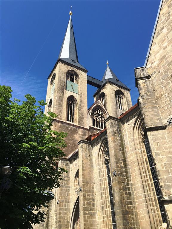

Halberstadt was heavily damaged during the war, We can find no mention of the churches being destroyed — and later rebuilt, but we suspect they were heavily damaged. The following Wiki quote gives some detail:
In the last days of World War II, in April 1945, US forces approached Halberstadt as they attacked remaining Nazi troops in the short-lived Harz pocket. They dropped leaflets instructing Halberstadt's Nazi ruler to fly a white flag on the town hall as a token of surrender. He refused, no white flag was raised and on 8 April 1945, 218 Flying Fortresses (B-17) of the 8th Air Force, accompanied by 239 escort fighters, dropped 595 tons of bombs on the centre of Halberstadt. This killed about 2,500 people and converted most of the old town into some 1.5 million cubic metres of rubble, which American troops briefly occupied three days later.
After leaving Halberstadt, we continued on to Zerbst. The photo below shows the Elbe river close to Zerbst. While not remarkable, the river seems to stand out in Lloyd’s memory – probably because he remembers that they had made a remarkable push to that location and perhaps there was a sense that the war in that area was won.

This will end the documentation of our travels that would trace the Battle of the Bulge. While we don’t pretend to say that we followed the exact route, we did follow the general route and got a bit of an impression of the geography and did a lot of thinking about war related items. Primary among those items was trying to imagine a 21 year old man from rural Iowa facing such terrible weather conditions and the terror of war. Those men (and women) really suffered.
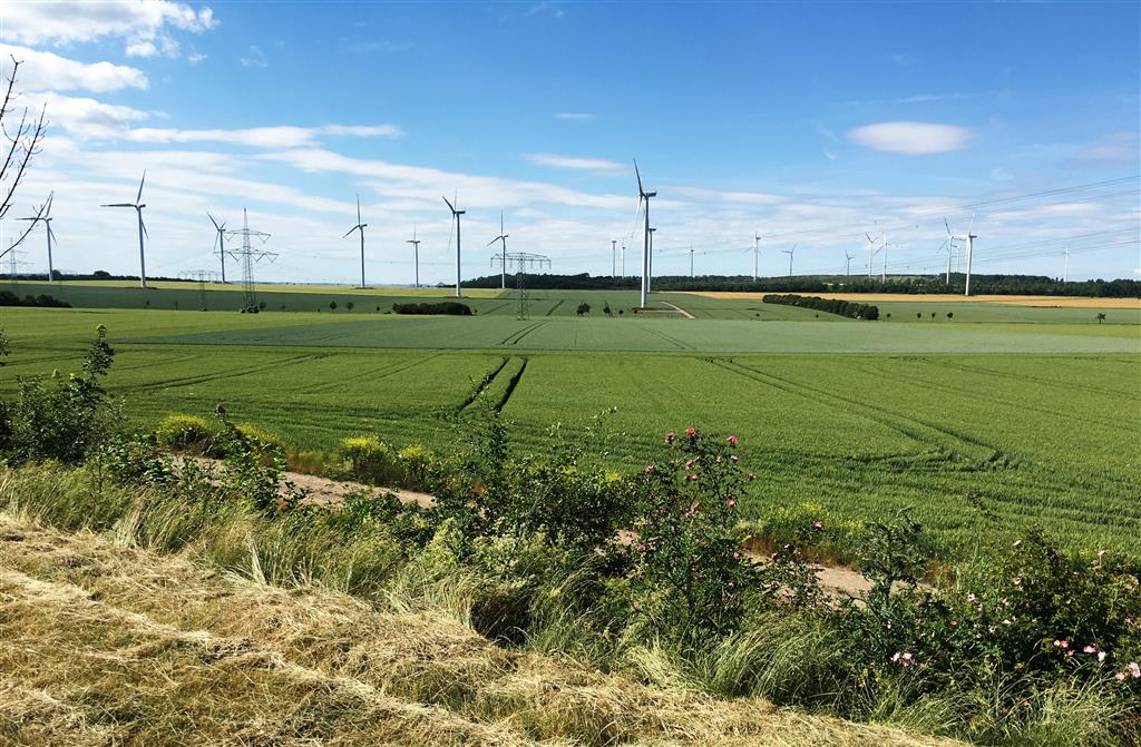
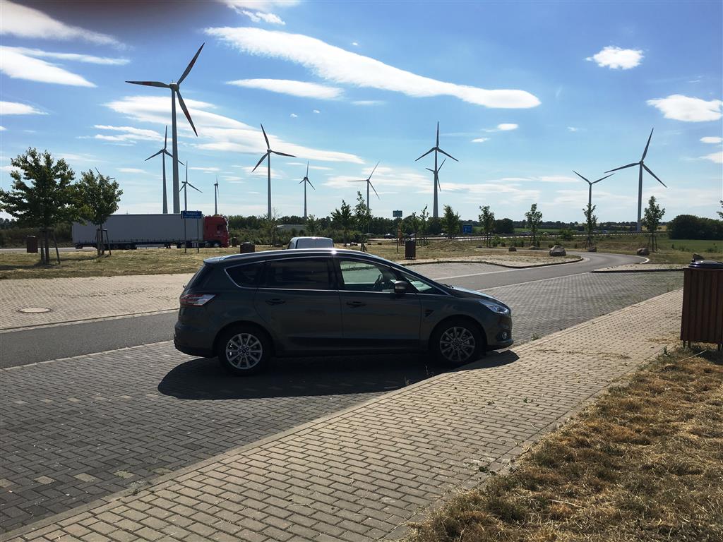
As we returned to Kassel, we took some pictures to document the scenery. One of the things that stood out in our travels was the number of wind turbines. They were everywhere. We did a bit of counting of groups and then extrapolated that to the number of groups we saw and would guess that we probably saw over 1,000 turbines in the two days of our travels. I have included a couple of photos to give you an idea. Both were taken at a rest stop and you could see turbines in every direction.
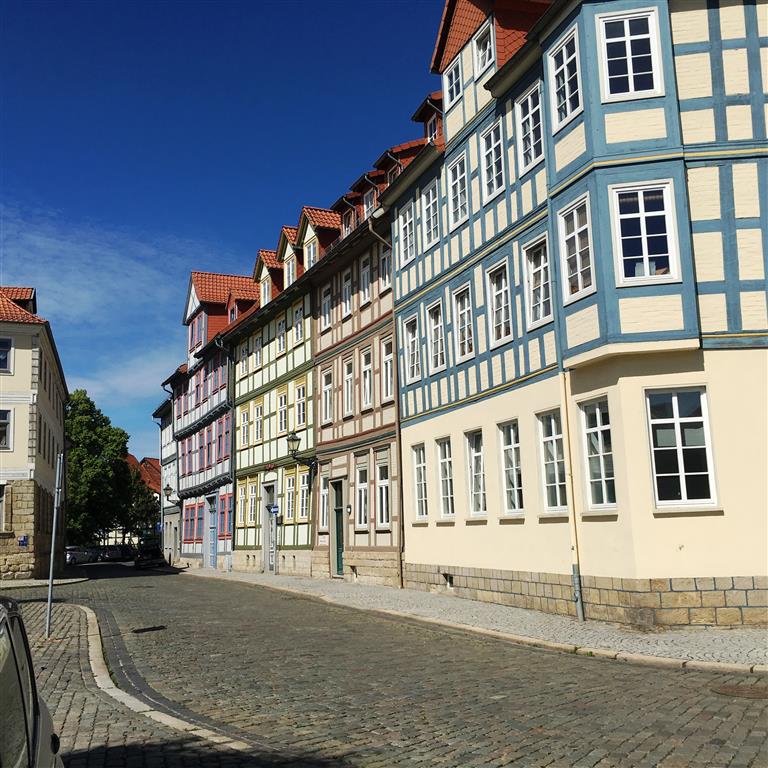
I also wanted to show the neat architecture of some of the buildings in Germany. They are often very ornate.
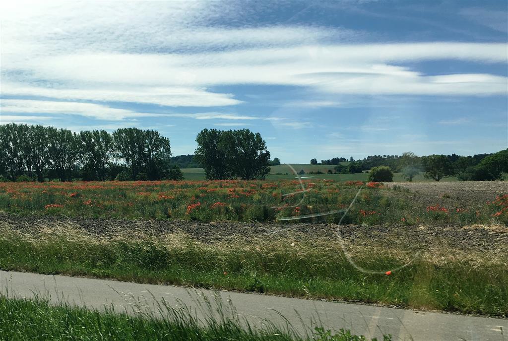
We also saw a lot of poppies in the fields. Our guess is that they are considered weeds, but they sure are pretty.
That is all for this post